
A powerful, sprawling winter storm is expected to slam much of the United States this week, bringing dangerous snow, ice and life‑threatening cold from Texas to New England. Forecasters warn the system could be one of the most disruptive of the season, with impacts on nearly half the U.S. population through the weekend and into early next week.
How big is this storm, and who is in the path?
Meteorologists say more than half of the U.S. could feel some impact from the winter storm between Friday and early next week. The system will stretch roughly 1,500–2,000 miles, with snow, sleet and freezing rain affecting at least 30–35 states at different times.
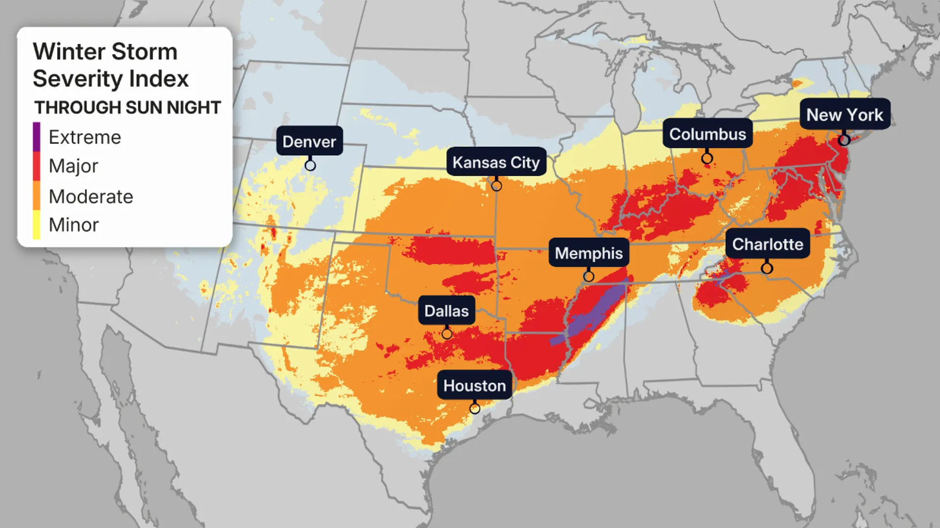
The heaviest snow band is expected from the southern Plains through the mid‑Mississippi and Ohio valleys into the Mid‑Atlantic and Northeast, while the southern flank of the storm brings a dangerous ice zone across parts of Texas, the Deep South, and the Carolinas. More than 200 million people could see either wintry precipitation or extreme cold, making it one of the most far‑reaching storms of the winter so far.
Timeline: What to expect this week
Late week: Storm forms and cold air arrives
Forecasters say the setup begins with an Arctic air mass plunging south and east across the Plains, Midwest and into the East. By Thursday and Friday, temperatures in parts of the northern Plains and Upper Midwest will run 20–30 degrees below normal, with wind chills dropping well below zero.
At the same time, a developing low‑pressure system over the Southwest and southern Plains taps Gulf moisture, setting the stage for a long‑duration winter storm. Lake‑effect snow on the front end of the Arctic blast will add up over the Great Lakes region, with some areas seeing up to two feet of snow before the main storm even arrives.
Friday–Saturday: Southern Plains to Midwest and South
The main storm is expected to really get going on Friday, spreading wintry precipitation across the southern Rockies and southern Plains. Areas from New Mexico and Texas through Oklahoma, Kansas and into the mid‑Mississippi Valley could see a mix of heavy snow, sleet, and freezing rain.
- The northern side of the system is forecast to bring 6–12 inches of snow to parts of Oklahoma, Kansas, and neighboring states, with locally higher totals possible.
- The southern side, including central and northern Texas, parts of Arkansas, Mississippi, Alabama, and the Carolinas, faces the risk of significant icing, with forecasters warning of “crippling” conditions where freezing rain is heaviest.
Officials warn that travel could rapidly become dangerous or impossible on stretches of interstates across the Plains and South, and that power lines and trees will be vulnerable where ice accretes.
Weekend into Monday: Mid‑Atlantic and Northeast
As the storm tracks east, snow, ice and strong winds are expected to spread into the Ohio Valley, Mid‑Atlantic and Northeast from Saturday into Monday.
- Cities from St. Louis to Chicago, Indianapolis, Pittsburgh, and Cleveland could see significant snow, with some locations likely to top 6 inches and others potentially exceeding a foot.
- Along the I‑95 corridor, from Washington, D.C. to New York City and potentially into Boston, forecasts point to a messy mix: snow to start, followed by sleet or freezing rain in some areas.
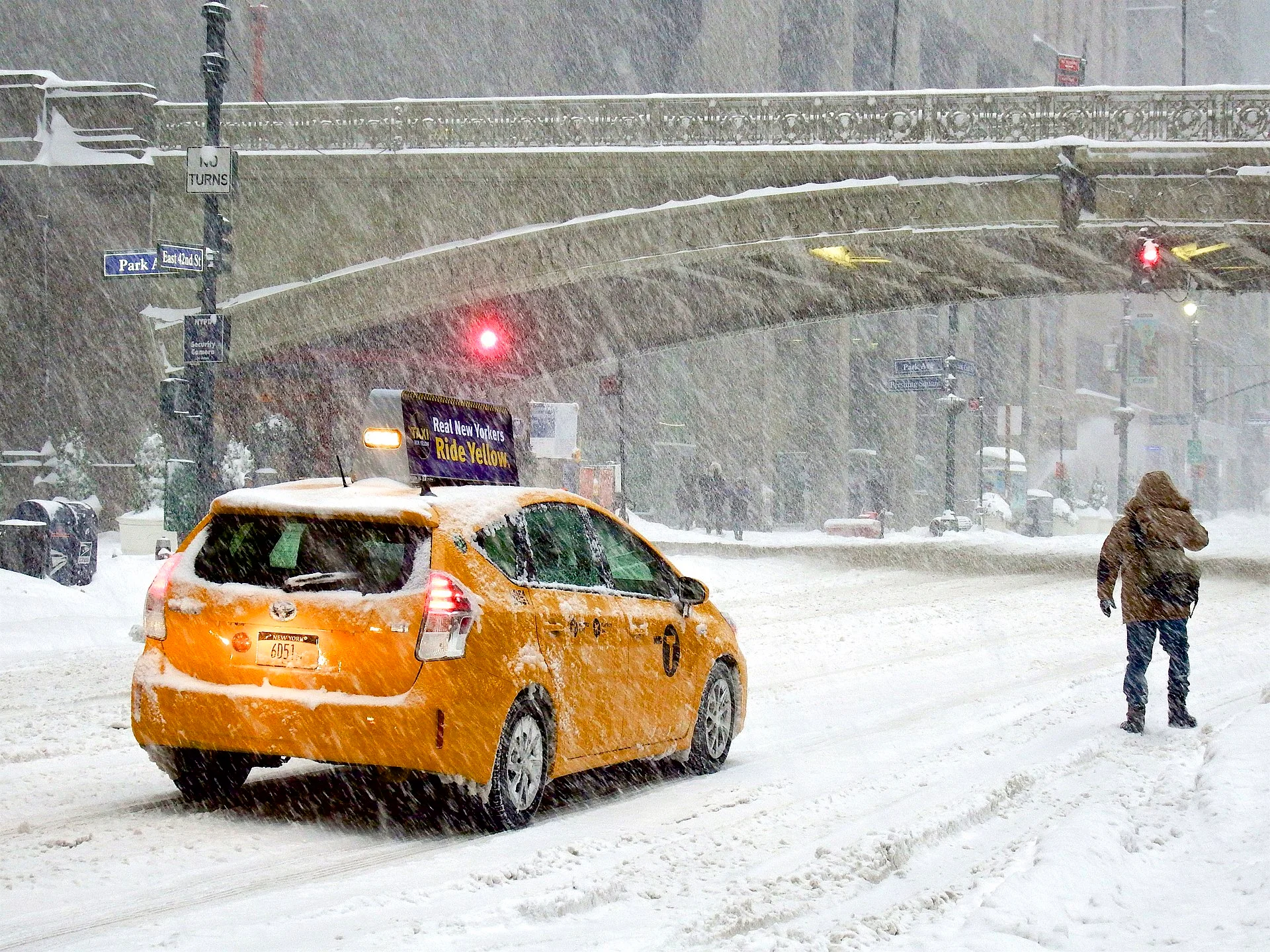
New York City and Philadelphia could see their first snowstorm of 6 inches or more in nearly four years if the track holds, though forecasters caution even a modest shift could change local totals dramatically. Snow showers and fast‑moving squalls may precede and follow the main storm, briefly dropping visibility to near zero and creating sudden white‑out conditions on highways.
Cold, wind and “high‑impact” risks
Arctic blast and record lows
Behind and beneath the storm, an Arctic air outbreak will lock in the impacts. Wind chills in parts of the northern Plains could plunge to minus‑35 or even minus‑50, conditions that pose a life‑threatening risk of frostbite on exposed skin in minutes.
As the cold spreads south and east, temperatures will run 20–40 degrees below average this weekend, with sub‑zero or single‑digit lows possible as far south as the central Plains and teens reaching toward the Gulf Coast. Cities such as Dallas–Fort Worth and Shreveport may challenge record low temperatures early next week.
Travel and power grids under pressure
Forecasters and emergency managers warn that the combination of snow, ice and extreme cold will magnify disruptions.
- Travel: Thousands of flight delays and cancellations are likely across major hubs from Dallas and Houston to Chicago, Atlanta, New York, and Boston, with highway travel snarled or shut down in parts of the Plains, Midwest, South and Northeast.
- Power: Heavy, wet snow and ice on trees and power lines, especially across the South and Mid‑Atlantic, could trigger widespread outages that may last for days if crews struggle to restore service in dangerous conditions.
Meteorologists emphasize that even relatively small shifts in the storm’s track will matter moving the rain‑snow line north or south by 50–100 miles can mean the difference between manageable snow and devastating ice for a given community.
What US residents should watch for
For audiences in the US and abroad, the storm is a vivid snapshot of how climate‑inflected extremes now play out in winter: rapid swings between unusually warm spells and punishing Arctic outbreaks, with storms that cover extraordinary distances. Scientists caution against tying a single storm directly to climate change but note that a warmer atmosphere can hold more moisture, often loading big winter systems with heavier snow and ice where cold air is present.
In practical terms, officials urge residents in the storm’s path to:
- Check the latest local forecasts frequently, as snow and ice zones can shift.
- Avoid non‑essential travel during the height of the storm and be prepared for sudden drops in visibility.
- Prepare for possible power outages with backup heat options that are safe to use indoors, along with food, water, and medications.
As one forecaster put it this week, this is not a routine January snow, it’s a high‑impact winter storm that will test everything from local road crews to national airline schedules.