
Relentless, tropics‑sourced rain is turning parts of Washington into a slow‑moving disaster zone, as an atmospheric river dumps trillions of gallons of water across the Pacific Northwest and swells rivers toward historic crests. Emergency officials warn that tens of thousands of residents could face evacuation orders if already‑flooded communities see additional downpours in the coming days, with forecasters calling this one of the most potent December rain events in recent memory.
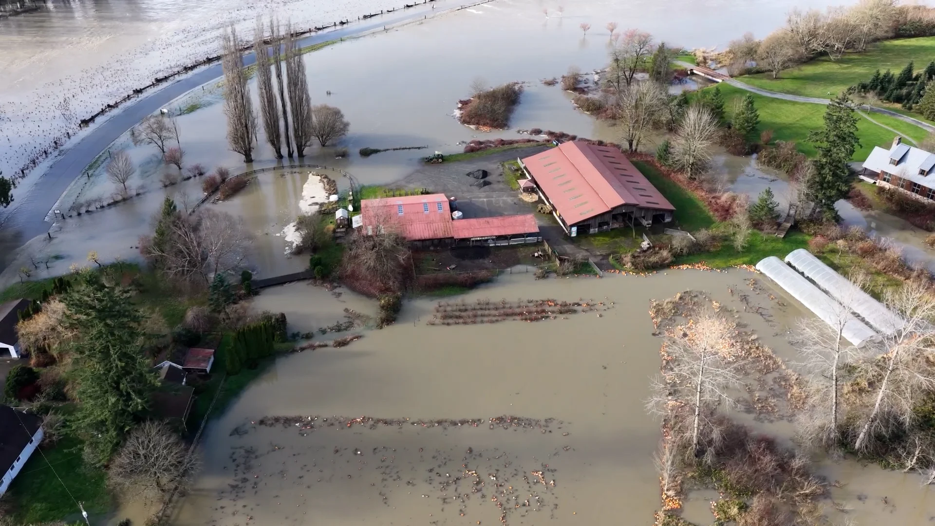
A River in the Sky Over Washington
Meteorologists trace the current deluge to a powerful atmospheric river, a long, narrow plume of moisture stretching roughly 7,000 miles from near the Philippines to the U.S. West Coast, that has parked itself over Washington and shifted south into Oregon before drifting back north. The National Weather Service and private forecasters say back‑to‑back storms embedded in this conveyor belt are wringing out inches of rain each day over the Olympics, Cascades, and lowlands alike.
Rainfall totals tell the story: high‑elevation sites such as Stampede Pass have already topped 9 inches of melted precipitation since the start of the week, while lowland areas across western Washington are on track to collect 2 to 6 inches, with localized higher amounts. In some mountain zones, meteorologists warn that December’s rainfall could end up twice the historical average, setting the stage for more flooding, mudslides, and unstable slopes even after skies begin to clear.
Rivers Rising, Roads Drowning
From the Skagit to the Chehalis, western Washington’s rivers are reacting quickly to the onslaught. Hydrologists expect several waterways to reach major flood stage, with the Skagit River projected to crest near or above 47 feet at Mount Vernon, close to or beyond previous records, while smaller rivers like the Grays have already broken long‑standing marks.
The impacts ripple outward:
- Low‑lying neighborhoods, farms and RV parks along riverbanks are seeing rapid inundation, forcing residents to stack sandbags, move vehicles and, in some cases, evacuate.
- Major and minor roadways are going under, with transportation officials warning drivers not to attempt crossings on flooded streets as swift water and hidden sinkholes turn commutes treacherous.
- Landslide risk is rising on saturated hillsides, steep bluffs and road cuts, particularly in areas scarred by recent wildfires where soil cohesion is weakest.
Local news footage shows rivers spilling over levees, backyards turned into ponds, and emergency crews carrying out water rescues across western Washington, as officials caution that the worst flooding on some rivers may lag the heaviest rain by many hours.
Communities on Alert from Seattle to Small Towns
In Seattle and surrounding King County, authorities have declared multiple “Weather Alert Days,” citing a combination of heavy rain, high winds and the threat of both river and urban flooding. A region‑wide flood watch is in effect through at least Friday, with the National Weather Service warning of “sharp rises” on creeks and streams that drain the Olympics and Cascades and of ponding in city streets as storm drains clog with debris.
City officials say they are:
- Pre‑positioning public works and utility crews to clear drains, close roads and respond to power outages.
- Coordinating with shelters and community centers in case evacuations are needed for residents in flood‑prone areas.
- Urging people to prepare for potential service disruptions and to avoid walking or driving through standing water.
Outside the metro core, rural communities face a different kind of strain. Farmers are moving livestock to higher ground, school districts are monitoring river gauges to decide on closures, and small businesses already hit by previous storms worry about another setback as access roads disappear beneath brown, churning runoff.
The Science Behind the Soaking
Atmospheric rivers are not new to the Pacific Northwest, but this event stands out for its persistence, alignment with a strong Pacific jet stream and the sheer volume of tropical moisture being funneled into a relatively small geographic area. Scientists compare these systems to “rivers in the sky”: while they make up a tiny fraction of the atmosphere at any given time, they can transport more water than the Amazon when fully developed.
Forecasters note several interacting ingredients:
- A robust trans‑Pacific jet stream steering storms straight into Washington and Oregon.
- Above‑average sea‑surface temperatures along parts of the storm track, which can supercharge evaporation and increase available moisture.
- A northward bulge in the jet over the West Coast, bringing unusual mid‑December warmth that raises snow levels and ensures much of the precipitation falls as rain rather than snow, accelerating runoff.
The same storm chain bringing rain to Washington is also tied to a wintry mix and heavy snow deeper inland, illustrating how a single pattern can deliver radically different hazards across regions.
Living with “New Normal” Storms
For many residents, this stretch of heavy rain feels like part of a broader shift in what counts as “normal” winter weather. While scientists caution against attributing a single event solely to climate change, studies have consistently found that a warming atmosphere can hold and transport more moisture, increasing the intensity of the heaviest downpours when conditions align.
Local officials and planners say Washington’s latest soaking raises once again the need to:
- Reinforce and, in some cases, redesign levees, bridges and culverts for more frequent high‑water events.
- Update landslide and floodplain maps in light of changing rainfall patterns and wildfire scars.
- Improve communication channels so residents receive timely, clear alerts, and know where to go when advised to leave.
For now, forecasters expect the atmospheric river to weaken and shift after mid‑week, bringing lighter rain later in the week even as saturated ground and high rivers keep the flood threat elevated. Another parade of Pacific storms, however, is already lining up on the long‑range models.