
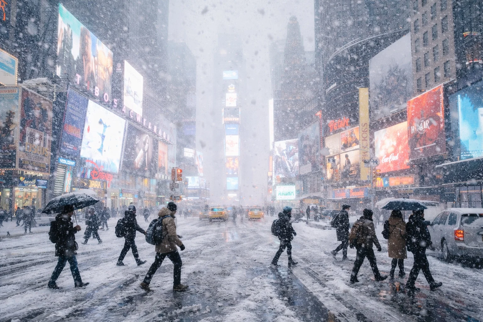
New York City is under its first blizzard warning in nearly a decade as a powerful nor’easter slams the Northeast with heavy, wind‑driven snow, prompting states of emergency, widespread travel disruption and what officials warn could be “dangerous to impossible” conditions into Monday. Forecasters say the storm is on track to dump 16–24 inches across the metro area with some bands capable of 2–3 inches an hour, while gusts up to 60 mph raise the risk of whiteouts, downed trees, power outages and coastal flooding from New Jersey through Long Island and southern New England.
A rare blizzard warning for New York City
The National Weather Service has issued blizzard warnings for New York City, Long Island and much of coastal New Jersey and southern New England as a rapidly deepening coastal low races up the Eastern Seaboard. ABC News notes that this is the first blizzard warning for the city since 2017 and the first for all 21 counties of New Jersey since the mid‑1990s.
By Sunday night, snow that began as a mix in some neighborhoods was intensifying into heavy, wind‑driven bands, and forecasters said the storm would “transition very rapidly” into a full‑fledged nor’easter. To meet the technical definition of a blizzard, winds must reach at least 35 mph and visibility must fall below a quarter‑mile for three consecutive hours as falling or blowing snow reduces sightlines, a threshold meteorologists say is likely to be met in parts of the metro area.
NBC New York is carrying continuous live coverage, with reporters describing near‑whiteout conditions on major arteries and a state of emergency still in effect as snow piles up.
How much snow, and when
Forecasts have shifted higher as the storm has strengthened offshore. Local and national outlets now broadly agree on 1–2 feet of snow for New York City and its suburbs, with some pockets potentially seeing more.
- FOX 5 New York projects 16–24 inches across the city, with “up to two feet” possible in some locations and heaviest totals likely in eastern Queens and Long Island.
- A Reddit summary of National Weather Service discussions notes that NYC and Long Island can expect 20–24 inches, with 16–20 inches inland and isolated 30‑inch maxima in the most intense bands.
- ABC News live updates report that snow has already reached 15 inches in New York City and more than 20 inches in parts of New Jersey and Long Island, with storm totals “on track to reach 1 to 2 feet” across much of the Northeast.
Timing is critical for residents planning work and school:
- CBS New York’s forecast, echoed by the NWS, calls for the heaviest snow from about 7 p.m. Sunday to midday Monday, with rates of 2–3 inches per hour possible overnight.
- ABC News says Long Island has already seen bursts of 3 inches per hour, a pace that quickly buries roads and overwhelms plows.
- Conditions should gradually improve Monday afternoon as the storm pulls away, though blowing snow and strong winds could keep visibility poor into the evening.
Officials warn that even short trips during peak hours could become hazardous, especially in open areas where drifting snow and gusts can suddenly erase the horizon.
Winds, power outages and coastal flooding
Snow totals tell only part of the story. The nor’easter is dragging powerful winds and coastal surges into one of the nation’s most densely populated corridors.
FOX 5’s forecast calls for sustained winds of 30–45 mph and gusts up to 60 mph, especially near the coasts. On Long Island, overnight observations have already shown gusts in the 40–50 mph range, and meteorologists expect similar or higher readings through Monday morning.
Those winds, combined with heavy, wet snow, are a recipe for:
- Downed tree limbs and power lines, leading to scattered to widespread outages.
- Whiteout conditions, with blowing snow cutting visibility to near zero on highways, bridges, and open stretches.
- Coastal flooding and beach erosion in vulnerable low‑lying areas of Long Island, Staten Island, the Jersey Shore, and southern New England as onshore winds pile water into bays and inlets.
ABC News reports that governors in New York and New Jersey cited the risk of people being left “in the dark” by falling lines as one of the main reasons for declaring states of emergency ahead of the storm.
States of emergency, travel chaos and school closures
New York Gov. Kathy Hochul and New Jersey Gov. Phil Murphy have both declared states of emergency, freeing up resources and allowing transportation restrictions as conditions deteriorate. Hochul warned that New York City, Long Island, and the Lower Hudson Valley are “literally in the direct eye of the storm.”
The transportation system is already under heavy strain:
- CNBC reports that major airlines including American, Delta, JetBlue and United waived change fees and canceled hundreds of flights across East Coast hubs through Tuesday, with New York’s JFK, LaGuardia, and Newark among the hardest hit.
- NBC and other outlets describe near‑gridlock at times on key highways, with plows struggling to keep up where snow is falling at multiple inches per hour.
- New York City has suspended in‑person classes in many public schools, shifting to remote learning in some cases, while suburban districts across New Jersey, Long Island and the Hudson Valley announced closures or delays.
City officials have urged residents to stay off the roads, use mass transit only if absolutely necessary and avoid unnecessary 911 calls so emergency crews can respond to genuine life‑threatening situations.
A test of city resilience
For New Yorkers who remember storms like the January 2016 blizzard or the February 2021 snowstorm, this nor’easter is shaping up as the most severe winter challenge in several years. ABC News notes that Monday’s totals could mark the heaviest single snowfall in more than five years for the city.
Sanitation crews have been working in around‑the‑clock shifts, with plows and salt spreaders deployed on primary and secondary routes. Emergency shelters and warming centers are open for people experiencing homelessness or those who lose power and heat, and coastal communities have been advised to move vehicles to higher ground where possible.
Officials stress that, despite sophisticated forecasting models, banding can create sharp differences in accumulation over short distances: one neighborhood may see a foot of snow while another, directly under a persistent band, gets nearly two feet. Residents are being urged to check trusted sources, especially the National Weather Service and local outlets, for hyper‑local updates rather than relying on a single number.
For now, the guidance is simple and blunt: stay home if you can, prepare for possible outages, and expect that New York City’s first blizzard warning in years will feel every bit like the historic winter storm forecasters have been warning about.