Powerful Storm Heads East From Alaska, Dropping Temperatures and Leaving Heavy Snow

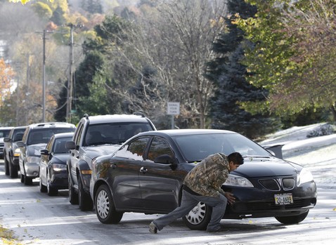
PIERRE, S.D.—Heavy snow blanketed parts of the Upper Midwest with more than a foot of snow on Tuesday, leaving residents there and in the Rockies waking up to frigid temperatures that plunged as much as 50 degrees overnight.
The rest of the Midwest and the East are expecting a dose of the icy weather later this week, thanks to a powerful storm that hit Alaska with hurricane-force winds over the weekend.
More than a foot of snow fell in northern Wisconsin, while Michigan’s Upper Peninsula was buried under more than 14 inches of powder with at least another foot expected before the storm moves out Wednesday. A much as 15 inches of snow has buried parts of Minnesota, and more snow is expected.
Schools canceled classes across the region, including at Northern Michigan University.
In Billings, Mont., temperatures in the high-60s fell into the single digits, and temperatures could bottom out around negative 20 degrees in the eastern part of the state overnight.
The blast of frigid air sent temperatures plunging as far south as the Texas Panhandle, where balmy 70-degree weather fell into the teens overnight. In Oklahoma City, Monday’s high of 80 degrees hit a low of 30 degrees Tuesday morning—a drop of 50 degrees.
And in the Dakotas, where single-digit temperatures—already about 30 degrees below normal—came with frigid wind chills, dipping as low as into the negative 20s in Dickinson, N.D.
Ranchers in the Dakotas were surprisingly upbeat with only a few inches of snow in the forecast, after intense storms in October 2013 killed at least 43,000 cattle that hadn’t yet developed heavy protective winter coats.
We’ve had enough cool weather [this year] that they’re haired up like bears, said South Dakota Stockgrowers Association President Bob Fortune, who ranches near Belvidere. They can take winter now.
Meteorologists are adamant that the weather isn’t because of the polar vortex, a giant upper air pattern that normally pens in cold air in the Arctic in the winter, but instead pushed in by a different weather phenomenon more related to the remnants of a powerful typhoon.
The polar vortex itself has not moved south. It’s still in the Arctic where it always is, said National Weather Service spokeswoman Susan Buchanan, adding that federal forecasters are calling this a cold snap or cold front.
Still, forecasters warn that the cold will linger. Some regions will go from record warm to record in just two days, with temperatures dropping 15 to 20 degrees below normal on the East Coast Friday and Saturday. And freezing temperatures will likely dip as far south as Atlanta on Friday, said Jeff Masters, meteorology director of the Weather Underground.


